

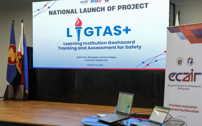


IN a major effort to shield students from chronic disruptions caused by natural disasters, the Department of Education (DepEd), under Education Secretary Sonny Angara, has launched the nationwide rollout of Project LIGTAS+ (Learning Institution Geohazard Tracking and Assessment for Safety).
The platform leverages artificial intelligence, satellite imaging, and geospatial analytics combined with school-level risk data.
By transforming fragmented hazard reports into real-time, actionable intelligence, the system enables education officials to respond rapidly before disaster strikes.
Addressing the urgency of the initiative, Secretary Angara stressed the necessity of moving beyond traditional resilience toward proactive disaster management.
The former lawmaker noted that relying solely on resilience is insufficient when young learners’ futures are at stake, emphasizing that authorities must identify specific risks, pinpoint affected areas, and act before hazards escalate into full-blown crises.
Data from the Second Congressional Commission on Education (EDCOM II) underscores the severity of the crisis, revealing that Philippine schools lose an average of 40 to 50 instructional days every year due to natural hazards—a gap that continuously deepens learning loss across the country.
Angara expressed confidence that the AI features of Project LIGTAS+ will deliver clearer, actionable information to support thousands of schools nationwide.
Developed by DepEd’s Disaster Risk Reduction and Management Service (DRRMS) in collaboration with the Education Center for AI Research (ECAIR), the system resolves long-standing data bottlenecks.
During a live demonstration, the platform showcased its capacity to cut situation report preparation time from several hours down to just five minutes. It actively monitors real-time metrics—including rainfall, extreme heat, wind speeds, and temperature spikes—to issue early warnings.
Beyond immediate emergency responses, Project LIGTAS+ will guide long-term educational infrastructure. Its geohazard mapping will inform disaster-resilient school design and allow strategic prepositioning of emergency learning kits, such as Edukahon, near vulnerable communities before typhoons hit.
The nationwide rollout was formalized through a joint commitment agreement between DepEd and key scientific partners, including DOST, PAGASA, PHIVOLCS, and the UP Resilience Institute, with policy rollouts and school-level training already underway.


